Moraine Township, Lake County, Illinois
| Moraine Township | |
|---|---|
| Township | |
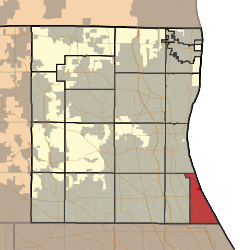 Location in Lake County | |
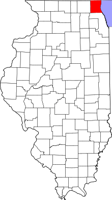 Lake County's location in Illinois | |
| Coordinates: 42°01′10″N 87°48′36″W / 42.01944°N 87.81000°WCoordinates: 42°01′10″N 87°48′36″W / 42.01944°N 87.81000°W | |
| Country | United States |
| State | Illinois |
| County | Lake |
| Government | |
| • Supervisor | Mari A. Barnes |
| Area | |
| • Total | 11.9 sq mi (30.9 km2) |
| • Land | 11.9 sq mi (30.8 km2) |
| • Water | 0.04 sq mi (0.1 km2) |
| Elevation | 646 ft (197 m) |
| Population (2010) | |
| • Total | 34,129 |
| • Density | 2,900/sq mi (1,100/km2) |
| Time zone | CST (UTC-6) |
| • Summer (DST) | CDT (UTC-5) |
| GNIS feature ID | 1848161 |
| Website |
www |
Moraine Township is a township in Lake County, Illinois, USA. As of the 2010 census, its population was 34,129.[1] Moraine Township was originally called Deerfield Township, but the name was changed on October 29, 1998.
Geography
Moraine Township covers an area of 11.9 square miles (30.9 km2); of this, 0.03 square miles (0.08 km2) or 0.27 percent is water.[1]
Cities and towns
- Deerfield (east edge)
- Highland Park (northeast three-quarters)
- Highwood
- Lake Forest (southeast edge)
Adjacent townships
- New Trier Township, Cook County (southeast)
- Northfield Township, Cook County (south)
- West Deerfield Township (west)
- Shields Township (northwest)
Cemeteries
The township contains seven cemeteries: Fort Sheridan, Garwood Family, Garwood Family, Mooney, Mound Rest, Mount Carmel and Saint Marys.
Major highways
Airports and landing strips
- Gieser Heliport
References
- 1 2 "Geographic Identifiers: 2010 Demographic Profile Data (G001): Moraine township, Lake County, Illinois". U.S. Census Bureau, American Factfinder. Retrieved December 19, 2012.
External links
Municipalities and communities of Lake County, Illinois, United States | ||
|---|---|---|
| Cities | | |
| Villages |
| |
| Townships | ||
| CDPs | ||
| Other unincorporated communities | ||
| Former settlement | ||
| Footnotes | ‡This populated place also has portions in an adjacent county or counties | |
This article is issued from Wikipedia - version of the 11/11/2014. The text is available under the Creative Commons Attribution/Share Alike but additional terms may apply for the media files.