Naâma Province
| Naâma Province ولاية النعامة | |
|---|---|
| Province | |
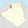
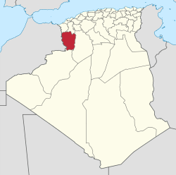 Map of Algeria highlighting Naâma | |
| Coordinates: 33°16′N 0°19′W / 33.267°N 0.317°WCoordinates: 33°16′N 0°19′W / 33.267°N 0.317°W | |
| Country |
 Algeria Algeria |
| Capital | Naâma |
| Government | |
| • Wāli | Mr. Hamidou Abdelhamid |
| Area | |
| • Total | 29,950 km2 (11,560 sq mi) |
| Population (2008)[1] | |
| • Total | 209,470 |
| • Density | 7.0/km2 (18/sq mi) |
| Time zone | CET (UTC+01) |
| Area Code | +213 (0) 49 |
| ISO 3166 code | DZ-45 |
| Districts | 7 |
| Municipalities | 12 |
Naâma Province (Arabic: ولاية النعامة) is a province (wilaya) of Algeria named after its provincial seat, the town of Naâma. The region is dominated by a large sabkha. There is an airport in Mécheria.
Administrative divisions
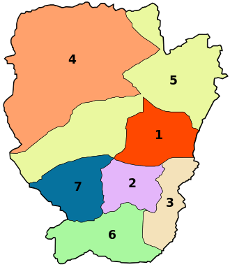
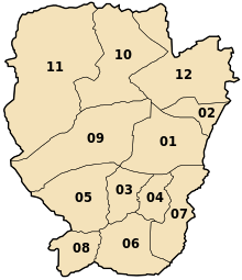
The province is divided into 7 districts (daïras), which are further divided into 12 communes or municipalities.
Districts
Communes
References
- ↑ Office National des Statistiques, Recensement General de la Population et de l’Habitat 2008 Preliminary results of the 2008 population census. Accessed on 2008-07-02.
 |
Wikimedia Commons has media related to Naâma Province. |
| | |
This article is issued from Wikipedia - version of the 3/11/2016. The text is available under the Creative Commons Attribution/Share Alike but additional terms may apply for the media files.