Ngqeleni
| Ngqeleni | |
|---|---|
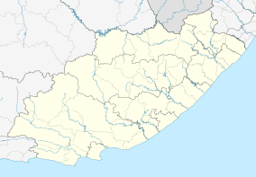  Ngqeleni  Ngqeleni  Ngqeleni
| |
| Coordinates: 31°40′12″S 29°01′41″E / 31.670°S 29.028°ECoordinates: 31°40′12″S 29°01′41″E / 31.670°S 29.028°E | |
| Country | South Africa |
| Province | Eastern Cape |
| District | O.R.Tambo |
| Municipality | Nyandeni |
| Area[1] | |
| • Total | 2.28 km2 (0.88 sq mi) |
| Population (2011)[1] | |
| • Total | 2,629 |
| • Density | 1,200/km2 (3,000/sq mi) |
| Racial makeup (2011)[1] | |
| • Black African | 97.2% |
| • Coloured | 1.6% |
| • Indian/Asian | 0.3% |
| • White | 0.3% |
| • Other | 0.5% |
| First languages (2011)[1] | |
| • Xhosa | 87.4% |
| • English | 7.0% |
| • Sign language | 1.6% |
| • Northern Sotho | 1.1% |
| • Other | 3.0% |
| Postal code (street) | 5140 |
| PO box | 5140 |
| Area code | 047 |
Ngqeleni is a town in O.R.Tambo District Municipality in the Eastern Cape province of South Africa.
Village in West Pondoland, 32 km southeast of Umtata and about 40 km north-north-west of Coffee Bay. The name is derived from the Xhosa ngqele, ‘cold’ or ‘frost’. Coldstream, which flows past it, may have a name translated from Ngqeleni, ‘at the cold’.[2]
References
- 1 2 3 4 "Main Place Ngqeleni". Census 2011.
- ↑ "Dictionary of Southern African Place Names (Public Domain)". Human Science Research Council. p. 335.
Municipalities and communities of OR Tambo District Municipality, Eastern Cape | ||
|---|---|---|
District seat: Mthatha | ||
| Ingquza Hill | .svg.png) | |
| Port St Johns | ||
| Nyandeni | ||
| Mhlontlo | ||
| King Sabata Dalindyebo | ||
This article is issued from Wikipedia - version of the 8/18/2016. The text is available under the Creative Commons Attribution/Share Alike but additional terms may apply for the media files.