Flagstaff, Eastern Cape
| Flagstaff | |
|---|---|
  Flagstaff  Flagstaff  Flagstaff
| |
| Coordinates: 31°4′48″S 29°30′16″E / 31.08000°S 29.50444°ECoordinates: 31°4′48″S 29°30′16″E / 31.08000°S 29.50444°E | |
| Country | South Africa |
| Province | Eastern Cape |
| District | O.R.Tambo |
| Municipality | Ingquza Hill |
| Government | |
| • Type | Ward 6 |
| • Councillor | Phumla Dutshwa |
| Area[1] | |
| • Total | 2.7 km2 (1.0 sq mi) |
| Population (2011)[1] | |
| • Total | 4,821 |
| • Density | 1,800/km2 (4,600/sq mi) |
| Racial makeup (2011)[1] | |
| • Black African | 95.7% |
| • Coloured | 0.6% |
| • Indian/Asian | 1.2% |
| • White | 0.3% |
| • Other | 2.1% |
| First languages (2011)[1] | |
| • IsiXhosa | 89.5% |
| • English | 3.2% |
| • Sesotho | 1.1% |
| • Other | 6.2% |
| Postal code (street) | 4810 |
| PO box | 4810 |
| Area code | 039 |
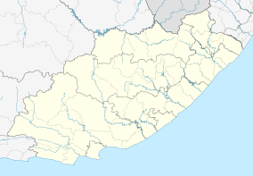
Flagstaff is a town in the OR Tambo District Municipality of the Eastern Cape province of South Africa located some 80 km south-east of Kokstad and 45 km north of Lusikisiki. It is the seat of the Ingquza Hill Local Municipality.
The town developed from a trading station established in 1877 and derives its name from the practice by the owners of hoisting a white flag on Sundays to indicate that the store was closed. For many years it served as a post of the Cape Mounted Rifles.[2]
References
- 1 2 3 4 Sum of the Subplaces Nkuluekweni SP and Flagstaff SP1 from Census 2011.
- ↑ "Dictionary of Southern African Place Names (Public Domain)". Human Science Research Council. p. 164.
Municipalities and communities of OR Tambo District Municipality, Eastern Cape | ||
|---|---|---|
District seat: Mthatha | ||
| Ingquza Hill | .svg.png) | |
| Port St Johns | ||
| Nyandeni | ||
| Mhlontlo | ||
| King Sabata Dalindyebo | ||
This article is issued from Wikipedia - version of the 11/3/2016. The text is available under the Creative Commons Attribution/Share Alike but additional terms may apply for the media files.