Nineveh Township, Adair County, Missouri
| Nineveh Township, Missouri | |
|---|---|
| Township | |
 | |
| Coordinates: 40°15′21″N 092°41′50″W / 40.25583°N 92.69722°WCoordinates: 40°15′21″N 092°41′50″W / 40.25583°N 92.69722°W | |
| Country | United States |
| State | Missouri |
| County | Adair |
| Area | |
| • Total | 54.41 sq mi (140.93 km2) |
| • Land | 54.28 sq mi (140.58 km2) |
| • Water | 0.14 sq mi (0.35 km2) 0.25% |
| Elevation[1] | 804 ft (245 m) |
| Population (2010) | |
| • Total | 1,289 |
| • Density | 24/sq mi (9.2/km2) |
| FIPS code | 29-52526[2] |
| GNIS feature ID | 0766214 |
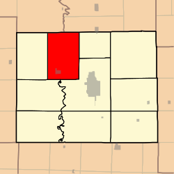
Nineveh Township is one of ten townships in Adair County, Missouri, United States. As of the 2010 census, its population was 1,289.[3] The township is named from the town of Nineveh, a German communistic colony that was established in the area in about 1850.[4]
Geography
Nineveh Township covers an area of 54.41 square miles (140.9 km2) and contains one incorporated settlement, Novinger. It contains two cemeteries: Nineveh and Novinger.
The streams of Brush Creek, Davis Branch, Hazel Creek, Little Hazel Creek, Mulberry Creek, Rye Creek, Shuteye Creek and Spring Creek run through this township.
References
- ↑ "US Board on Geographic Names". United States Geological Survey. 2007-10-25. Retrieved 2008-01-31.
- ↑ "American FactFinder". United States Census Bureau. Retrieved 2008-01-31.
- ↑ "Geographic Identifiers: 2010 Demographic Profile Data (G001): Nineveh township, Adair County, Missouri". U.S. Census Bureau, American Factfinder. Retrieved June 20, 2013.
- ↑ Violette, E. M. (1911). History of Adair County. The Denslow History Company. p. 39.
External links
Municipalities and communities of Adair County, Missouri, United States | ||
|---|---|---|
| Cities | 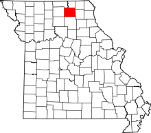 | |
| Villages | ||
| Townships | ||
| Unincorporated communities | ||
| Ghost towns | ||
| Footnotes | ‡This populated place also has portions in an adjacent county or counties | |
This article is issued from Wikipedia - version of the 11/3/2016. The text is available under the Creative Commons Attribution/Share Alike but additional terms may apply for the media files.