North Crane, Indiana
| North Crane | |
|---|---|
| Unincorporated community | |
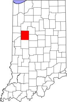 Tippecanoe County's location in Indiana | |
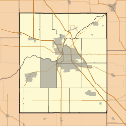  North Crane Location in Tippecanoe County | |
| Coordinates: 40°20′18″N 86°48′35″W / 40.33833°N 86.80972°W | |
| Country | United States |
| State | Indiana |
| County | Tippecanoe |
| Township | Wea |
| Elevation[1] | 679 ft (207 m) |
| Time zone | EST (UTC-5) |
| • Summer (DST) | EDT (UTC-4) |
| ZIP code | 47909 |
| Area code(s) | 765 |
| GNIS feature ID | 440239 |
North Crane is a small unincorporated community in Wea Township, Tippecanoe County, Indiana.[2]
History
The town began as a stop on the Indianapolis, Cincinnati and Lafayette Railroad line running southeast out of Lafayette and was known as Culver's Station, named for a nearby landowner.[3]
Geography
North Crane is located at 40°20′18″ N, 86°48′35″ W (40.338333, -86.809722) on the eastern edge of Wea Township. It has an elevation of approximately 679 feet.[4] One visible reminder of North Crane is the former Crane Station elevator, which can be seen from U.S. 52, just south of Lafayette.
References
- ↑ "US Board on Geographic Names". United States Geological Survey. 2007-10-25. Retrieved 2008-01-31.
- ↑ "North Crane, Indiana". Geographic Names Information System. United States Geological Survey. Retrieved 2016-07-25.
- ↑ Indiana Historical Society. Maps of Indiana Counties in 1876. 1968. (Reprinted from Illustrated Historical Atlas of the State of Indiana. Chicago: Baskin, Forster & Company, 1876.)
- ↑ "USGS Topographic Map Quad" (map). TopoQuest. Retrieved 2008-06-30.
External links
- Map: 40°20′18″N 86°48′35″W / 40.33833°N 86.80972°WCoordinates: 40°20′18″N 86°48′35″W / 40.33833°N 86.80972°W
Municipalities and communities of Tippecanoe County, Indiana, United States | ||
|---|---|---|
| Cities | | |
| Towns | ||
| Townships | ||
| CDPs | ||
| Other unincorporated communities |
| |
| Ghost towns | ||
| Footnotes | ‡This populated place also has portions in an adjacent county or counties | |
This article is issued from Wikipedia - version of the 7/26/2016. The text is available under the Creative Commons Attribution/Share Alike but additional terms may apply for the media files.