Gariep Dam (town)
| Gariep Dam Gariepdam | |
|---|---|
|
View over Gariep Dam | |
  Gariep Dam  Gariep Dam  Gariep Dam
| |
| Coordinates: 30°36′S 25°30′E / 30.6°S 25.5°ECoordinates: 30°36′S 25°30′E / 30.6°S 25.5°E | |
| Country | South Africa |
| Province | Free State |
| District | Xhariep |
| Municipality | Kopanong |
| Established | ~1964 |
| Government | |
| • Type | Municipality |
| • Mayor | Xolile Mathwa (ANC) |
| Area[1] | |
| • Total | 24.83 km2 (9.59 sq mi) |
| Elevation | 1,320 m (4,330 ft) |
| Population (2011)[1] | |
| • Total | 1,568 |
| • Density | 63/km2 (160/sq mi) |
| Racial makeup (2011)[1] | |
| • Black African | 31.0% |
| • Coloured | 47.6% |
| • Indian/Asian | 0.4% |
| • White | 19.6% |
| • Other | 1.3% |
| First languages (2011)[1] | |
| • Afrikaans | 76.9% |
| • Xhosa | 11.1% |
| • English | 4.9% |
| • Sotho | 4.6% |
| • Other | 2.5% |
| Postal code (street) | 9922 |

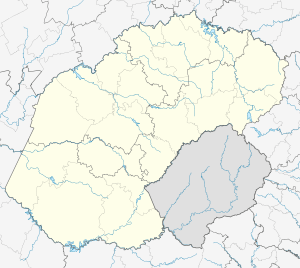
Gariep Dam (Afrikaans: Gariepdam), founded as "Oranjekrag", is a settlement in Xhariep District Municipality in the Free State (province) of South Africa.
Gariep Dam is a township on the northern bank of the Orange River, 50 km west of Bethulie and 48 km north-east of Colesberg. It was laid out in 1965-66 to accommodate the builders of the dam. The previous name is Afrikaans and means "Orange (River) power".[2] The town acquired its current name in 1996.[3]
References
- 1 2 3 4 "Main Place Gariep Dam". Census 2011.
- ↑ "Dictionary of Southern African Place Names (Public Domain)". Human Science Research Council. p. 352.
- ↑ Elwyn Jenkins (2007-01-01). Falling Into Place: The Story of Modern South African Place Names. New Africa Books. p. 135. ISBN 978-0-86486-689-9.
 |
Philippolis | Trompsburg Springfontein |
Bethulie | |
 |
||||
| ||||
 | ||||
| Colesberg | Norvalspont | Venterstad Steynsburg |


Municipalities and communities of Xhariep District Municipality, Free State | ||
|---|---|---|
District seat: Trompsburg | ||
| Kopanong | .svg.png) | |
| Letsemeng | ||
| Mohokare | ||
| Naledi | ||
This article is issued from Wikipedia - version of the 11/25/2016. The text is available under the Creative Commons Attribution/Share Alike but additional terms may apply for the media files.