Papum Pare district
| Papum Pare district | |
|---|---|
| District of Arunachal Pradesh | |
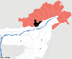 Location of Papum Pare district in Arunachal Pradesh | |
| Country | India |
| State | Arunachal Pradesh |
| Headquarters | Yupia |
| Area | |
| • Total | 2,875 km2 (1,110 sq mi) |
| Population (2011) | |
| • Total | 176,385[1] |
| Demographics | |
| • Literacy | 82.1%[1] |
| • Sex ratio | 950[1] |
| Website | Official website |
Papum Pare district (Pron:/ˌpæpəm ˈpæɹɪ or ˈpɑ:ɹeɪ/) is an administrative district in the state of Arunachal Pradesh in India. As of 2011 it is the most populous district of Arunachal Pradesh (out of 20).[2]
History
The district was formed in 1999 when it was split from Lower Subansiri district.[3]
Geography
The district headquarters are located at Yupia. Papum Pare district occupies an area of 2,875 square kilometres (1,110 sq mi).[4] The capital of the state is Itanagar, which is also located in Papum Pare.
Divisions
The district is divided into two sub-divisions: Sagalee and Yupia Capital complex, which are further divided into 10 administrative circles, namely, Mengio, Leporiang, Sagalee, Toru, Kimin, Doimukh, Balijan, Tarasso, Naharlagun and Itanagar.
There are 3 Arunachal Pradesh Legislative Assembly constituencies located in this district: Itanagar, Doimukh and Sagalee. All of these are part of Arunachal West Lok Sabha constituency.[5]
Demographics
According to the 2011 census Papum Pare district has a population of 176,385,[6] roughly equal to the nation of Sao Tome and Principe.[7] This gives it a ranking of 594th in India (out of a total of 640).[6] The district has a population density of 51 inhabitants per square kilometre (130/sq mi) .[6] Its population growth rate over the decade 2001–2011 was 44.57%.[6] Papumpare has a sex ratio of 950 females for every 1000 males,[6] and a literacy rate of 82.14%.[6]
Papum Pare is inhabited by members of the Nyishi, who are traditionally followers of Donyi-Polo. Some members of the Nyishi tribe are followers of Christianity.[8]
Flora and fauna
In 1978 Papum Pare district became home to the Itanagar Wildlife Sanctuary, which has an area of 140 km2 (54.1 sq mi).[9]
References
- 1 2 3 "District Census 2011". Census2011.co.in.
- ↑ "District Census 2011". Census2011.co.in. 2011. Retrieved 2011-09-30.
- ↑ Law, Gwillim (25 September 2011). "Districts of India". Statoids. Retrieved 2011-10-11.
- ↑ Srivastava, Dayawanti et al. (ed.) (2010). "States and Union Territories: Arunachal Pradesh: Government". India 2010: A Reference Annual (54th ed.). New Delhi, India: Additional Director General, Publications Division, Ministry of Information and Broadcasting (India), Government of India. p. 1113. ISBN 978-81-230-1617-7.
- ↑ "Assembly Constituencies allocation w.r.t District and Parliamentary Constituencies". Chief Electoral Officer, Arunachal Pradesh website. Retrieved 2 May 2011.
- 1 2 3 4 5 6 "District Census 2011". Census2011.co.in. 2011. Retrieved 2011-09-30.
- ↑ US Directorate of Intelligence. "Country Comparison: Population". Retrieved 2011-10-01.
Sao Tome and Principe 179,506 July 2011 est.
- ↑ http://papumpare.nic.in/
- ↑ Indian Ministry of Forests and Environment. "Protected areas: Arunachal Pradesh". Retrieved 25 September 2011.
External links
 |
Wikimedia Commons has media related to Papum Pare district. |
 |
Kurung Kumey district | Lower Subansiri district | | |
| East Kameng district |  |
|||
| ||||
 | ||||
| Sonitpur district, Assam | Lakhimpur district, Assam |


Coordinates: 27°09′00″N 93°43′12″E / 27.15000°N 93.72000°E