Pearsall, Western Australia
| Pearsall Perth, Western Australia | |||||||||||||
|---|---|---|---|---|---|---|---|---|---|---|---|---|---|
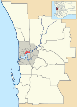  Pearsall Location in metropolitan Perth | |||||||||||||
| Coordinates | 31°46′55″S 115°49′05″E / 31.782°S 115.818°ECoordinates: 31°46′55″S 115°49′05″E / 31.782°S 115.818°E | ||||||||||||
| Population | 2,572 (2011 census[1]) | ||||||||||||
| • Density | 1,710/km2 (4,440/sq mi) | ||||||||||||
| Postcode(s) | 6065 | ||||||||||||
| Area | 1.5 km2 (0.6 sq mi) | ||||||||||||
| LGA(s) | City of Wanneroo | ||||||||||||
| State electorate(s) | Wanneroo | ||||||||||||
| Federal Division(s) | Cowan | ||||||||||||
| |||||||||||||
Pearsall is a suburb of Perth, Western Australia in the City of Wanneroo. Until the late 1990s it was the southernmost part of the suburb of Wanneroo.
References
- ↑ Australian Bureau of Statistics (31 October 2012). "Pearsall (State Suburb)". 2011 Census QuickStats. Retrieved 2016-03-10.
Suburbs and localities of the City of Wanneroo, Perth, Western Australia | ||
|---|---|---|
| North West | 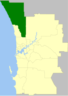 | |
| North East | ||
| South | ||
¹ Suburb shared with the City of Joondalup | ||
This article is issued from Wikipedia - version of the 3/10/2016. The text is available under the Creative Commons Attribution/Share Alike but additional terms may apply for the media files.