Rockbridge, Ohio
| Rockbridge, Ohio | |
|---|---|
| Unincorporated community | |
|
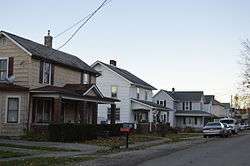
Jackson Street houses south of the post office | |
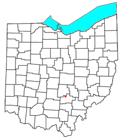 Location of Rockbridge, Ohio | |
| Coordinates: 39°34′47″N 82°31′20″W / 39.57972°N 82.52222°WCoordinates: 39°34′47″N 82°31′20″W / 39.57972°N 82.52222°W | |
| Country | United States |
| State | Ohio |
| County | Hocking |
| Time zone | Eastern (EST) (UTC-5) |
| • Summer (DST) | EDT (UTC-4) |
| ZIP code | 43149 |
| Area code(s) | 740 |
Rockbridge is an unincorporated community in eastern Good Hope Township, Hocking County, Ohio, United States. Although it is unincorporated, it has a post office, with the ZIP code of 43149.[1] It is located at the interchange of U.S. Route 33 and State Route 374, between Logan and Lancaster. The population was 2552 at the 2010 U.S. census.[2]
The area around Rockbridge contains many tourist destinations including portions of the Hocking Hills State Park System and Clear Creek, part of the Columbus Metro Parks system.
A post office called Rockbridge has been in operation since 1863.[3] The community is named after a natural bridge formed in a large section of sandstone, which stretches more than 100 feet long and 10 to 20 feet wide over a ravine on a small offshoot of the Hocking River.[4][5]
References
- ↑ USPS Zip Code Lookup
- ↑ American FactFinder, United States Census Bureau
- ↑ "Hocking County". Jim Forte Postal History. Retrieved 10 December 2015.
- ↑ Hocking Hills State Parks, Rockbridge State Nature Preserve.
- ↑ History of Hocking Valley, Ohio. Inter-State Publishing Co. 1883. p. 1143.
Municipalities and communities of Hocking County, Ohio, United States | ||
|---|---|---|
| City | 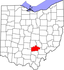 | |
| Villages | ||
| Townships | ||
| CDPs | ||
| Unincorporated communities | ||
| Footnotes | ‡This populated place also has portions in an adjacent county or counties | |