Saïda Province
| Saïda Province ولاية سعيدة | |
|---|---|
| Province | |
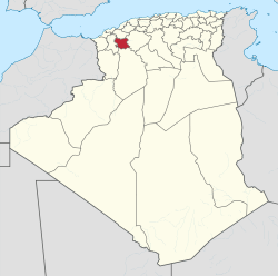 Map of Algeria highlighting Saïda | |
| Coordinates: 34°50′N 0°09′E / 34.833°N 0.150°ECoordinates: 34°50′N 0°09′E / 34.833°N 0.150°E | |
| Country |
 Algeria Algeria |
| Capital | Saïda |
| Area | |
| • Total | 6,764 km2 (2,612 sq mi) |
| Population (2008)[1] | |
| • Total | 328,685 |
| • Density | 49/km2 (130/sq mi) |
| Time zone | CET (UTC+01) |
| Area Code | +213 (0) 48 |
| ISO 3166 code | DZ-20 |
| Districts | 6 |
| Municipalities | 16 |
Saïda (Arabic: ولاية سعيدة) is a province (wilaya) of Algeria, named after its capital.
Administrative divisions
The province is divided into 6 districts (daïras), which are further divided into 16 communes or municipalities.
Districts
Communes
References
- ↑ Office National des Statistiques, Recensement General de la Population et de l’Habitat 2008 Preliminary results of the 2008 population census. Accessed on 2008-07-02.
Capital: Saïda | ||
| Districts | 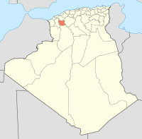 | |
| Communes | ||
| | |
This article is issued from Wikipedia - version of the 3/11/2016. The text is available under the Creative Commons Attribution/Share Alike but additional terms may apply for the media files.