Saint-Omer, Quebec
Not to be confused with Saint-Omer, Gaspésie–Îles-de-la-Madeleine, Quebec.
| Saint-Omer | |
|---|---|
| Municipality | |
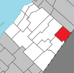 Location within L'Islet RCM | |
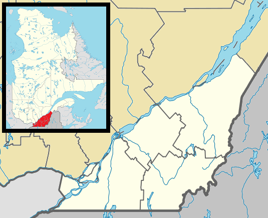  Saint-Omer Location in southern Quebec | |
| Coordinates: 47°03′N 69°44′W / 47.050°N 69.733°WCoordinates: 47°03′N 69°44′W / 47.050°N 69.733°W[1] | |
| Country |
 Canada Canada |
| Province |
 Quebec Quebec |
| Region | Chaudière-Appalaches |
| RCM | L'Islet |
| Constituted | January 1, 1954 |
| Government[2] | |
| • Mayor | Huguette Gauthier-Roy |
| • Federal riding |
Montmagny—L'Islet— Kamouraska—Rivière- du-Loup |
| • Prov. riding | Côte-du-Sud |
| Area[2][3] | |
| • Total | 122.40 km2 (47.26 sq mi) |
| • Land | 122.40 km2 (47.26 sq mi) |
| Population (2011)[3] | |
| • Total | 310 |
| • Density | 2.5/km2 (6/sq mi) |
| • Pop 2006-2011 |
 9.6% 9.6% |
| • Dwellings | 200 |
| Time zone | EST (UTC−5) |
| • Summer (DST) | EDT (UTC−4) |
| Postal code(s) | G0R 4R0 |
| Area code(s) | 418 and 581 |
| Highways | No major routes |
Saint-Omer is a municipality in L'Islet Regional County Municipality in the Chaudière-Appalaches region of Quebec, Canada.
See also
References
External links
-
 Media related to Saint-Omer, Quebec at Wikimedia Commons
 |
Sainte-Perpétue | |
Petit-Lac-Sainte-Anne | |
 |
||||
| ||||
 | ||||
| Saint-Pamphile | |
 United States United States Northwest Aroostook, Maine |


| Cities & Towns | |
|---|---|
| Municipalities | |
| Parishes | |
| |
This article is issued from Wikipedia - version of the 12/1/2016. The text is available under the Creative Commons Attribution/Share Alike but additional terms may apply for the media files.