Saint-Pascal, Quebec
| Saint-Pascal | |
|---|---|
| City | |
 | |
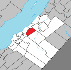 Location within Kamouraska RCM | |
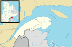  Saint-Pascal Location in eastern Quebec | |
| Coordinates: 47°32′N 69°48′W / 47.533°N 69.800°WCoordinates: 47°32′N 69°48′W / 47.533°N 69.800°W[1] | |
| Country |
 Canada Canada |
| Province |
 Quebec Quebec |
| Region | Bas-Saint-Laurent |
| RCM | Kamouraska |
| Constituted | March 1, 2000 |
| Government[2] | |
| • Mayor | Renald Bernier |
| • Federal riding | Montmagny—L'Islet—Kamouraska—Rivière-du-Loup |
| • Prov. riding | Côte-du-Sud |
| Area[2][3] | |
| • Total | 60.20 km2 (23.24 sq mi) |
| • Land | 59.34 km2 (22.91 sq mi) |
| Population (2011)[3] | |
| • Total | 3,490 |
| • Density | 58.8/km2 (152/sq mi) |
| • Pop 2006-2011 |
 0.4% 0.4% |
| • Dwellings | 1,578 |
| Time zone | EST (UTC−5) |
| • Summer (DST) | EDT (UTC−4) |
| Postal code(s) | G0L 3Y0 |
| Area code(s) | 418 and 581 |
Highways   A-20 (TCH) A-20 (TCH) |
 Route 230 Route 230 |
| Website |
www |
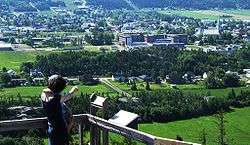
Saint-Pascal is a city in Kamouraska Regional County Municipality in the Bas-Saint-Laurent region of Quebec.
Municipal council
- Mayor: Cécile Joseph
- Councillors: Renald Bernier, Daniel Drapeau, Claude Lavoie, Rémi Pelletier, Francine Soucy, Yvan Soucy
See also
References
External links
-
 Media related to Saint-Pascal, Quebec at Wikimedia Commons
 |
Kamouraska | Saint-Germain | Sainte-Hélène-de-Kamouraska | |
| Saint-Philippe-de-Néri |  |
|||
| ||||
 | ||||
| Mont-Carmel | Saint-Bruno-de-Kamouraska |


| Cities & Towns | |
|---|---|
| Municipalities | |
| Parishes | |
| Unorganized territories | |
| |
This article is issued from Wikipedia - version of the 12/1/2016. The text is available under the Creative Commons Attribution/Share Alike but additional terms may apply for the media files.