Saskatchewan Highway 10
| ||||
|---|---|---|---|---|
| Route information | ||||
| Length: | 219 km (136 mi) | |||
| Major junctions | ||||
| West end: |
 Hwy 1 (TCH) near Balgonie Hwy 1 (TCH) near Balgonie | |||
.svg.png) Hwy 22 Hwy 22.svg.png) Hwy 35 near Fort Qu'Appelle Hwy 35 near Fort Qu'Appelle.svg.png) .svg.png) Hwy 15 / Hwy 47 at Melville Hwy 15 / Hwy 47 at Melville.svg.png)  Hwy 9 / Hwy 16 (TCH) at Yorkton Hwy 9 / Hwy 16 (TCH) at Yorkton.svg.png) .svg.png) Hwy 8 north / Hwy 80 near Wroxton Hwy 8 south near Manitoba border Hwy 8 north / Hwy 80 near Wroxton Hwy 8 south near Manitoba border | ||||
| East end: |
Manitoba border continues as  PTH 5 PTH 5 | |||
| Location | ||||
| Rural municipalities: | Edenwold, South Qu'Appelle, North Qu'Appelle, Abernethy, McLeod, Stanley, Cana, Orkney, Wallace, Calder | |||
| Major cities: | Yorkton | |||
| Towns: | Fort Qu'Appelle, Melville | |||
| Highway system | ||||
|
Provincial highways in Saskatchewan
| ||||
.svg.png)
Highway 10 is a provincial paved undivided highway in the Canadian province of Saskatchewan.[1] It runs from Highway 1 near Balgonie until it transitions into PTH 5 at the Manitoba border. Highway 10 is about 219 km (136 mi.) long.
Highway 10 passes through Fort Qu'Appelle, Balcarres, Melville, and Yorkton. It intersects Highway 1 and Highway 16.
Intersections from east to west
| Rural municipality | Location | km[2] | mi | Destinations | Notes |
|---|---|---|---|---|---|
| Calder No. 241 | Manitoba border | 0 | 0.0 | PTH 5 east – Roblin, Grandview, Dauphin | Hwy 10 begins |
| 3 | 1.9 | .svg.png) Hwy 369 north – Togo Hwy 369 north – Togo | |||
| 5 | 3.1 | Hwy 8 south – MacNutt, Langenburg, Spy Hill, Moosomin | Concurrency with Hwy 8 begins | ||
| 13 | 8.1 | Calder access road | |||
| Wroxton | 24 | 15 | Hwy 8 north – Kamsack, Pelly, Norquay Hwy 80 south – Churchbridge, Esterhazy | Concurrency with Hwy 8 ends | |
| Wallace No. 243 | Dunleath | 45 | 28 | 637  | Concurrency with Hwy 637 begins |
| Tonkin | 49 | 30 | 637 | Concurrency with Hwy 637 ends | |
| City | Yorkton | 63 | 39 | Hwy 9 north – Canora, Sturgis, Hudson Bay Hwy 16 (TCH) west – Foam Lake, Wynyard, Saskatoon Hwy 16 (TCH) west – Foam Lake, Wynyard, SaskatoonHwy 10A west / Hwy 16A west (Broadway St.) | Hwy 10 turns left begin concurrence with Hwy 9 south and Hwy 16 east |
| 65 | 40 | Hwy 9 south – Stockholm, Whitewood, Carlyle Hwy 16 (TCH) east – Saltcoats, Langenburg, Russell, Minnedosa, Winnipeg | Hwy 10 turns right end concurrence with Hwy 9 south and Hwy 16 east | ||
| 68 | 42 | Hwy 10A east – Yorkton (City Centre) | Hwy 10 turns southwest and leaves Yorkton Hwy 10 travels southwest for its duration | ||
| Town | Melville | 102 | 63 | Hwy 47 north – Willowbrook, Springside, Buchanan, Preeceville | Concurrency with Hwy 47 begins |
| 103 | 64 | Hwy 15 – Raymore, Leross, Ituna, Bredenbury | Concurrency with Hwy 47 continues | ||
| 104 | 65 | Hwy 47 south – Grenfell, Stoughton, Estevan | Concurrency with Hwy 47 ends | ||
| Stanley No. 215 | 112 | 70 | 618 | ||
| 129 | 80 | 617 | |||
| Abernethy No. 186 | 144 | 89 | Hwy 22 east – Abernethy, Dubuc, Stockholm, Esterhazy | Concurrency with Hwy 22 begins | |
| Balcarres | 152 | 94 | .svg.png) Hwy 310 north – Ituna, Foam Lake, Kuroki Hwy 310 north – Ituna, Foam Lake, Kuroki619 | Concurrency with Hwy 22 continues | |
| Town | Fort Qu'Appelle | 172 | 107 | Hwy 22 west – Cupar, Southey, Earl Grey Hwy 35 north – Leross, Wadena, Tisdale.svg.png) Hwy 56 – Indian Head, Lebret, Echo Valley Provincial Park Hwy 56 – Indian Head, Lebret, Echo Valley Provincial Park.svg.png) Hwy 210 south – Echo Valley Provincial Park Hwy 210 south – Echo Valley Provincial Park | Concurrency with Hwy 22 ends Concurrency with Hwy 35 begins Hwy 56 passes underneath Hwy 10/22 just east of Fort Qu'Appelle |
| North Qu'Appelle No. 187 | 182 | 113 | Hwy 35 south – Qu'Appelle, Weyburn, Oungre | Concurrency with Hwy 35 ends | |
| 184 | 114 | Hwy 210 north – Echo Valley Provincial Park, Fort Qu'Appelle | |||
| South Qu'Appelle No. 157 | Edgeley | 194 | 121 | .svg.png) Hwy 364 west – Avonhurst, Edenwold, Balgonie Hwy 364 west – Avonhurst, Edenwold, Balgonie | |
| Edenwold No. 158 | 219 | 136 | Hwy 1 (TCH) – Winnipeg, Brandon, Regina, Moose Jaw | Hwy 10 merges on to Hwy 1 westbound; no eastbound access Hwy 10 ends | |
| 1.000 mi = 1.609 km; 1.000 km = 0.621 mi | |||||
References
- ↑ "TYPE ADMN_CLASS TOLL_RD RTE_NUM1 RTE_NUM2 ROUTE 1 Gravel ...". Government of Canada. Retrieved 2008-02-17.
- ↑ Microsoft Streets and Tips (Map) (2004 ed.). Microsoft Corporation Redmond Washington.
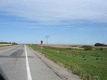
Echo Valley Scenic Route Sk Hwy 10
Junction 42 Chamberlain ahead Saskatchewan Highway 2 (north); Central Butte turn left, (West) Saskatchewan Highway 42 Road Signage. Photo taken from Saskatchewan Highway 2 travelling north from Moose Jaw to Saskatchewan Highway 11
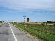
Scenic Route

Adopt a Highway Saskatchewan Highway 10.
This article is issued from Wikipedia - version of the 2/3/2016. The text is available under the Creative Commons Attribution/Share Alike but additional terms may apply for the media files.