TB, Maryland
| TB, Maryland | |
|---|---|
| Unincorporated community | |
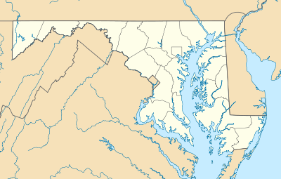  TB, Maryland  TB, Maryland Location within the state of Maryland | |
| Coordinates: 38°42′04″N 76°52′28″W / 38.70111°N 76.87444°WCoordinates: 38°42′04″N 76°52′28″W / 38.70111°N 76.87444°W | |
| Country |
 United States of America United States of America |
| State |
 Maryland Maryland |
| County |
 Prince George's Prince George's |
| Elevation | 236 ft (72 m) |
| Time zone | Eastern (EST) (UTC-5) |
| • Summer (DST) | EDT (UTC-4) |
| GNIS feature ID | 598145 |
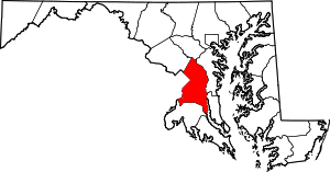
TB is an unincorporated community in Prince George's County, in the U.S. state of Maryland,[1] near the intersection of highways MD 5 and US 301.[2]
History
A post office called T.B. was established in 1860, and remained in operation until 1914.[3] TB has been noted for its short place name.[4] The origin of the name TB is disputed.[5]
References
- ↑ U.S. Geological Survey Geographic Names Information System: TB, Maryland
- ↑ "MD 0005 Branch Avenue US 301 at TB to Auth Road (North of I-95/I-495)". Maryland State Highway Administration. Retrieved October 14, 2015.
- ↑ "Prince George's County". Jim Forte Postal History. Retrieved 14 October 2015.
- ↑ International, Rotary (July 1981). The Rotarian. Rotary International. p. 20. ISSN 0035-838X.
- ↑ Fesperman, Dan (March 30, 2001). "A wide spot in the road". The Baltimore Sun. Retrieved 14 October 2015.
This article is issued from Wikipedia - version of the 10/23/2016. The text is available under the Creative Commons Attribution/Share Alike but additional terms may apply for the media files.