Thompson Beach, South Australia
| Thompson Beach South Australia | |||||||||||||
|---|---|---|---|---|---|---|---|---|---|---|---|---|---|
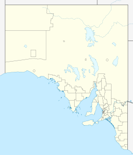  Thompson Beach | |||||||||||||
| Coordinates | 34°29′11″S 138°17′02″E / 34.48639588°S 138.28388254°ECoordinates: 34°29′11″S 138°17′02″E / 34.48639588°S 138.28388254°E | ||||||||||||
| Population | 334 (shared with other localities within the “State Suburb of Thompson Beach”) (2011 census)[1][lower-alpha 1] | ||||||||||||
| Established | 1997[2] | ||||||||||||
| Postcode(s) | 5501[3] | ||||||||||||
| Time zone | ACST (UTC+9:30) | ||||||||||||
| • Summer (DST) | ACST (UTC+10:30) | ||||||||||||
| Location | 56 km (35 mi) north of Adelaide city centre | ||||||||||||
| LGA(s) | Adelaide Plains Council[2] | ||||||||||||
| State electorate(s) | Goyder[4] | ||||||||||||
| Federal Division(s) | Wakefield[5] | ||||||||||||
| |||||||||||||
| |||||||||||||
| Footnotes |
Location[3] Coordinates[2] Climate[6] Adjoining localities[2] | ||||||||||||
Thompson Beach is a locality in the Australian state of South Australia located on the eastern coastline of Gulf St Vincent about 56 kilometres (35 mi) north of the Adelaide city centre.[3][2] Thompson Beach started as a sub-division in 1980 with boundaries being created in June 1997.[2][7] Land use with the locality is principally residential with built development being of a ‘low density’.[7] Thompson Beach is located within the federal Division of Wakefield, the state electoral district of Goyder, and the local government area of the Adelaide Plains Council.[5][4][2]
See also
References
- Notes
- ↑ For the 2011 census, the ‘State Suburb of Thompson Beach’ consisted of the localities of Dublin (minus the settled area on the Port Wakefield Road) and Thompson Beach)
- Citations
- ↑ Australian Bureau of Statistics (31 October 2012). "Thompson Beach". 2011 Census QuickStats. Retrieved 12 June 2016.
- 1 2 3 4 5 6 7 "Search result for "Thompson Beach (LOCB)" (Record no SA0062513) with the following layers selected - "Suburbs and Localities"". Property Location Browser. Government of South Australia. Retrieved 12 June 2016.
- 1 2 3 "(Postcode for) Thompson Beach, South Australia". Postcodes Australia. Retrieved 12 June 2016.
- 1 2 "Goyder electorate boundaries as of 2012". ELECTORAL COMMISSION SA. Retrieved 23 July 2015.
- 1 2 "Federal electoral division of Wakefield" (PDF). Australian Electoral Commission. Retrieved 23 July 2015.
- ↑ "Monthly climate statistics: Summary statistics Edinburgh RAAF". Commonwealth of Australia , Bureau of Meteorology. Retrieved 12 June 2016.
- 1 2 "Development Plan, Mallala Council, consolidated May 2014" (PDF). Government of South Australia. pp. 10, 137 and 258–260. Retrieved 23 July 2015.
This article is issued from Wikipedia - version of the 10/3/2016. The text is available under the Creative Commons Attribution/Share Alike but additional terms may apply for the media files.