Val-Alain, Quebec
| Val-Alain | |
|---|---|
| Municipality | |
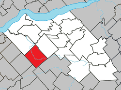 Location within Lotbinière RCM. | |
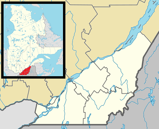  Val-Alain Location in southern Quebec. | |
| Coordinates: 46°25′N 71°45′W / 46.417°N 71.750°WCoordinates: 46°25′N 71°45′W / 46.417°N 71.750°W[1] | |
| Country |
 Canada Canada |
| Province |
 Quebec Quebec |
| Region | Chaudière-Appalaches |
| RCM | Lotbinière |
| Constituted | January 1, 1950 |
| Government[2] | |
| • Mayor | Rénald Grondin |
| • Federal riding |
Lotbinière— Chutes-de-la-Chaudière |
| • Prov. riding | Lotbinière-Frontenac |
| Area[2][3] | |
| • Total | 102.90 km2 (39.73 sq mi) |
| • Land | 102.32 km2 (39.51 sq mi) |
| Population (2011)[3] | |
| • Total | 955 |
| • Density | 9.3/km2 (24/sq mi) |
| • Pop 2006-2011 |
 6.0% 6.0% |
| • Dwellings | 446 |
| Time zone | EST (UTC−5) |
| • Summer (DST) | EDT (UTC−4) |
| Postal code(s) | G0S 3H0 |
| Area code(s) | 418 and 581 |
| Website |
www |
Val-Alain is a municipality in the Municipalité régionale de comté de Lotbinière in Quebec, Canada. It is part of the Chaudière-Appalaches region and the population is 930 as of 2009. It is named after Alain Chartier Joly de Lotbinière, grandson of Henri-Gustave Joly de Lotbinière, former premier of Quebec. "Monsieur Alain," as he was known, headed the Lotbinière seigneurie from 1911 to 1954.
References
- Commission de toponymie du Québec
- Ministère des Affaires municipales, des Régions et de l'Occupation du territoire
External links
- Val-Alain municipal website
 |
Leclercville | Saint-Janvier-de-Joly | | |
| Villeroy |  |
|||
| ||||
 | ||||
| Notre-Dame-de-Lourdes | Laurierville | Lyster |


| Municipalities | |
|---|---|
| Parishes | |
| Villages | |
| |
This article is issued from Wikipedia - version of the 4/7/2013. The text is available under the Creative Commons Attribution/Share Alike but additional terms may apply for the media files.