Wild Rice, North Dakota
| Wild Rice, North Dakota | |
|---|---|
| Unincorporated community | |
|
Looking north at Wild Rice | |
  Wild Rice  Wild Rice | |
| Coordinates: 46°44′47″N 96°48′34″W / 46.74639°N 96.80944°WCoordinates: 46°44′47″N 96°48′34″W / 46.74639°N 96.80944°W | |
| Country | United States |
| State | North Dakota |
| County | Cass |
| Elevation | 909 ft (277 m) |
| Time zone | Central (CST) (UTC-6) |
| • Summer (DST) | CDT (UTC-5) |
| Area code(s) | 701 |
| GNIS feature ID | 1032805[1] |
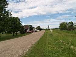
Wild Rice is an unincorporated community in Cass County, North Dakota, United States. Wild Rice is located near the Wild Rice River 9 miles (14 km) south of downtown Fargo.[2]
History
Wild Rice was platted in 1884 when the railroad was extended to that point.[3] A post office called Wild Rice was established in 1884, and remained in operation until 1970.[4] The community was originally built up chiefly by French Canadians.[5]
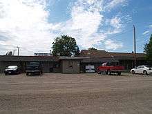
Wild Rice Bar & Grill
References
- ↑ "Wild Rice". Geographic Names Information System. United States Geological Survey.
- ↑ Cass County, North Dakota General Highway Map (PDF) (Map). North Dakota Department of Transportation. 2004. p. 1. Retrieved July 16, 2012.
- ↑ Hoheisel, Tim; Nielsen, Andrew R. (2007). Cass County. Arcadia Publishing. p. 82. ISBN 978-0-7385-4145-7.
- ↑ "Cass County". Jim Forte Postal History. Retrieved 24 October 2015.
- ↑ Federal Writers' Project (1938). North Dakota, a Guide to the Northern Prairie State. WPA. p. 195. ISBN 978-1-62376-033-5.
Municipalities and communities of Cass County, North Dakota, United States | ||
|---|---|---|
| Cities | 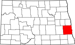 | |
| Townships |
| |
| CDPs | ||
| Unincorporated communities | ||
| Footnotes | ‡This populated place also has portions in an adjacent county or counties | |
This article is issued from Wikipedia - version of the 11/1/2016. The text is available under the Creative Commons Attribution/Share Alike but additional terms may apply for the media files.