Zion, New Jersey
| Zion, New Jersey | |
|---|---|
| Unincorporated community | |
|
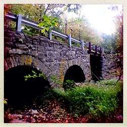
Rock Brook Bridge in Zion | |
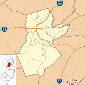  Zion, New Jersey  Zion, New Jersey  Zion, New Jersey Location of Zion in Somerset County. Inset: Location of Somerset County within the state of New Jersey. | |
| Coordinates: 40°26′26″N 74°44′19″W / 40.44056°N 74.73861°WCoordinates: 40°26′26″N 74°44′19″W / 40.44056°N 74.73861°W | |
| Country |
 United States United States |
| State |
 New Jersey New Jersey |
| County | Somerset |
| Township | Hillsborough and Montgomery |
| Elevation[1] | 111 m (364 ft) |
| Time zone | Eastern (EST) (UTC-5) |
| • Summer (DST) | EDT (UTC-4) |
| GNIS feature ID | 881993[1] |
Zion is an unincorporated community along the border of Hillsborough Township and Montgomery Township in Somerset County, New Jersey, United States.[1][2][3][4][5] It is located on Rock Brook, approximately 3 mi (4.8 km) north of Hopewell.
The Rock Brook Bridge in Zion is listed on the National Register of Historic Places.[6]
References
- 1 2 3 U.S. Geological Survey Geographic Names Information System: Zion
- ↑ Locality Search, State of New Jersey. Accessed January 21, 2015.
- ↑ History, Montgomery Township, New Jersey. Accessed January 21, 2015. "There are several hamlets within the Township: Belle Mead, Blawenburg, Dutchtown, Harlingen, Rocky Hill, Skillman and Zion."
- ↑ Google (January 21, 2015). "Zion, New Jersey" (Map). Google Maps. Google. Retrieved January 21, 2015.
- ↑ Google (January 21, 2015). "Hillsborough Township, New Jersey" (Map). Google Maps. Google. Retrieved January 21, 2015.
- ↑ "Rock Brook Bridge". National Park Service. Retrieved January 2015. Check date values in:
|access-date=(help)
Municipalities and communities of Somerset County, New Jersey, United States | ||
|---|---|---|
| Boroughs |  | |
| Townships | ||
| CDPs | ||
| Other unincorporated communities | ||
This article is issued from Wikipedia - version of the 6/10/2016. The text is available under the Creative Commons Attribution/Share Alike but additional terms may apply for the media files.