Balarang, New South Wales
| Balarang Wollongong, New South Wales | |||||||||||||
|---|---|---|---|---|---|---|---|---|---|---|---|---|---|
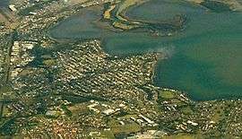 Aerial photo from east | |||||||||||||
| Coordinates | 34°33′27″S 150°50′00″E / 34.55750°S 150.83333°ECoordinates: 34°33′27″S 150°50′00″E / 34.55750°S 150.83333°E | ||||||||||||
| Postcode(s) | 2529 | ||||||||||||
| LGA(s) | City of Shellharbour | ||||||||||||
| State electorate(s) | Shellharbour | ||||||||||||
| Federal Division(s) | Throsby | ||||||||||||
| |||||||||||||
Balarang is a suburb of Wollongong, New South Wales, Australia, located on the southern shore of Lake Illawarra. It is officially designated an urban place,[1] and forms the eastern end of the suburb of Oak Flats.
The name is said to mean "place of swamp oak".
See also
References
- ↑ "Balarang". Geographical Names Register (GNR) of NSW. Geographical Names Board of New South Wales. Retrieved 17 May 2009.
This article is issued from Wikipedia - version of the 7/2/2016. The text is available under the Creative Commons Attribution/Share Alike but additional terms may apply for the media files.