Camp Eighteen, California
Coordinates: 39°37′37″N 121°10′13″W / 39.62694°N 121.17028°W
| Camp Eighteen | |
|---|---|
| Unincorporated community | |
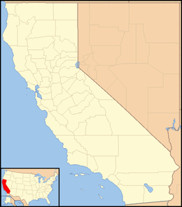  Camp Eighteen  Camp Eighteen Location in California | |
| Coordinates: 39°37′37″N 121°10′13″W / 39.62694°N 121.17028°W | |
| Country | United States |
| State | California |
| County | Butte County |
| Elevation[1] | 3,947 ft (1,203 m) |
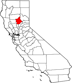
Camp Eighteen is an unincorporated community in Butte County, California, about 1.25 miles (2.01 km) from the Plumas County line. It lies 7 miles (11 km) north of Clipper Mills,[2] at an elevation of 3947 feet (1203 m). The ZIP Code is 95940. The community is inside area code 530. Nearby communities are Lumpkin and Rogerville. The now-defunct Feather River Railway used to serve the area but appears to have been decommissioned. Sly Creek Reservoir is about 3.6 miles (5.8 km) southeast.
See also
References
- ↑ U.S. Geological Survey Geographic Names Information System: Camp Eighteen, California
- ↑ Durham, David L. (1998). California's Geographic Names: A Gazetteer of Historic and Modern Names of the State. Clovis, Calif.: Word Dancer Press. p. 206. ISBN 1-884995-14-4.
External links
This article is issued from Wikipedia - version of the 7/14/2016. The text is available under the Creative Commons Attribution/Share Alike but additional terms may apply for the media files.