Dayr Aban
| Dayr Aban | |
|---|---|
  Dayr Aban | |
| Arabic | دير آبان |
| Name meaning | The Monastery of Aban[1] |
| Subdistrict | Jerusalem |
| Coordinates | 31°44′34.60″N 35°00′37.45″E / 31.7429444°N 35.0104028°ECoordinates: 31°44′34.60″N 35°00′37.45″E / 31.7429444°N 35.0104028°E |
| Palestine grid | 151/127 |
| Population | 2100 (1945) |
| Area | 22,734 dunams |
| Date of depopulation | October 19–20, 1948[2] |
| Cause(s) of depopulation | Military assault by Yishuv forces |
| Current localities | Tzor'a, Machseya, Beyt Shemesh, and Yish'i |
Dayr Aban (also spelled Deir Aban; Arabic: دير آبان) was a Palestinian Arab village in the Jerusalem Subdistrict, located on the lower slope of a high ridge that formed the western slope of a mountain, to the east of Beit Shemesh. It was formerly bordered by olive trees to the north, east, and west. The valley, Wadi en-Najil, ran north and south on the west-side of the village. It was depopulated during the 1948 Arab-Israeli War on October 19, 1948, under Operation Ha-Har. It was located 21 km west of Jerusalem. In pre-Roman and Roman times the settlement was referred to as Abenezer.[3]
In 1596, Dayr Aban appeared in Ottoman tax registers as being in the Nahiya of Quds of the Liwa of Quds. It had a population of 23 Muslim households and 23 Christian households. It paid taxes on wheat, barley, olives, and goats or beehives.[4]
Victor Guérin described the village in the 19th century as being a large village, and its adjacent valley "strewn with sesame."[5]
According to a census conducted in 1931 by the British Mandate authorities, Dayr Aban had a population of 1534 inhabitants, in 321 houses.[6]
In 1945, the village had a total population of 2,100. Dayr Abban had a mosque and a pipeline transporting water from 'Ayn Marjalayn, 5 km to the east. The village contains three khirbats: Khirbat Jinna'ir, Khirbat Haraza, and Khirbat al-Suyyag.
Today, near the site of the old village, is built the moshav, Mahseya.[7]
Etymology
The prefix "Dayr" which appears in many village names is of Aramaic and Syriac-Aramaic origin, and has the connotation of "habitation," or "dwelling place," usually given to places where there was once a Christian population, or settlement of monks. In most cases, a monastery was formerly built there, and, throughout time, the settlement expanded.[8] Dayr Aban would, therefore, literally mean, "the Monastery of Aban."
Gallery
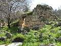 Dayr Aban-Ruin
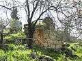 Dayr Aban, stone wall
 Dayr Aban, stone façade
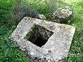 Dayr Aban, Cistern
 Dayr Aban
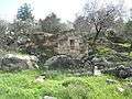 Dayr Aban-Ruin
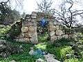 Dayr Aban, in sunlight
 Ruins of Dayr Aban, wall
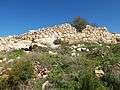 The outer wall of structure in Dayr Aban
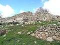 Ruins of Dayr Aban
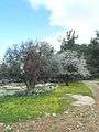 Dayr Aban, Olive and Almond Tree
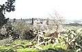 Dayr Aban on the Background of Beit Shemesh
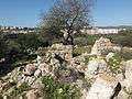 The ruins of Dayr Aban overlooking Beit Shemesh
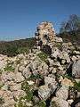 Projecting wall, in Dayr Aban
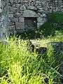 What remains of the inside wall of a house, with niche in wall
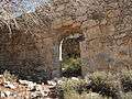 Front wall of house in Dayr Aban
.JPG) Razed buildings in Dayr Aban
Razed buildings in Dayr Aban Mouth of pit, one of many in Dayr Aban
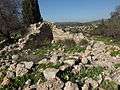 Razed structures in Dayr Aban
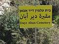 A sign post of the cemetery in Dayr Aban
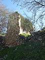 What remains of a house still stands tall
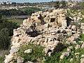 Old structures in Dayr Aban
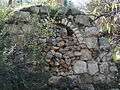 Sealed Archway in Dayr Aban
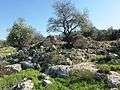 House and tree amidst ruins, in Dayr Aban
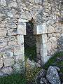 Entranceway to house now abandoned. Dayr Aban
References
- ↑ Palmer, 1881, p.293
- ↑ Morris, 2004, p. xx, village #335. Also gives cause of depopulation.
- ↑ C.R. Conder, Notes from the Memoir, Palestine Exploration Quarterly, vol. 18, London 1876, p. 149; Conder & Kitchener, The Survey of Western Palestine, vol. iii (Judaea), London 1883, p. 24
- ↑ Hütteroth and Abdulfattah, 1977, p. 119
- ↑ Victor Guérin,Description Géographique, Historique et Archéologique de la Palestine (Judaea. Third Volume), Paris 1869, p. 323
- ↑ Mills, 1932, p. 19
- ↑ Yalqut Teiman, Yosef Tobi and Shalom Seri (editors), Tel-Aviv 2000, p. 158, s.v. מחסיה (Hebrew) ISBN 965-7121-03-5
- ↑ Al-Shabeshti, Diyārāt (Monasteries).
Bibliography
 |
Wikimedia Commons has media related to Dayr Aban. |
- Barron, J. B., ed. (1923). Palestine: Report and General Abstracts of the Census of 1922. Government of Palestine.
- Conder, Claude Reignier; Kitchener, H. H. (1883). The Survey of Western Palestine: Memoirs of the Topography, Orography, Hydrography, and Archaeology. 3. London: Committee of the Palestine Exploration Fund. (p. 24)
- Dauphin, Claudine (1998). La Palestine byzantine, Peuplement et Populations. BAR International Series 726 (in French). III : Catalogue. Oxford: Archeopress. ISBN 0-860549-05-4. (p. 909)
- Guérin, Victor (1869). Description Géographique Historique et Archéologique de la Palestine (in French). 1: Judee, pt. 2. Paris: L'Imprimerie Nationale. (pp. 22-23)
- Hadawi, Sami (1970). Village Statistics of 1945: A Classification of Land and Area ownership in Palestine. Palestine Liberation Organization Research Centre.
- Hütteroth, Wolf-Dieter; Abdulfattah, Kamal (1977). Historical Geography of Palestine, Transjordan and Southern Syria in the Late 16th Century. Erlanger Geographische Arbeiten, Sonderband 5. Erlangen, Germany: Vorstand der Fränkischen Geographischen Gesellschaft. ISBN 3-920405-41-2.
- Khalidi, Walid (1992). All That Remains: The Palestinian Villages Occupied and Depopulated by Israel in 1948. Washington D.C.: Institute for Palestine Studies. ISBN 0-88728-224-5.
- Mills, E., ed. (1932). Census of Palestine 1931. Population of Villages, Towns and Administrative Areas. Jerusalem: Government of Palestine. (p. 19)
- Morris, Benny (2004). The Birth of the Palestinian Refugee Problem Revisited. Cambridge University Press. ISBN 978-0-521-00967-6.
- Palmer, E. H. (1881). The Survey of Western Palestine: Arabic and English Name Lists Collected During the Survey by Lieutenants Conder and Kitchener, R. E. Transliterated and Explained by E.H. Palmer. Committee of the Palestine Exploration Fund.
External links
- Welcome To Dayr Aban
- Survey of Western Palestine, Map 17: IAA, Wikimedia commons
- Dayr Aban, from the Khalil Sakakini Cultural Center
- Dayr Aban دير آبان Palestine Family.net