Fingerville, South Carolina
| Fingerville | |
|---|---|
| CDP | |
  Fingerville Location within the state of South Carolina | |
| Coordinates: 35°08′06″N 82°00′01″W / 35.13500°N 82.00028°WCoordinates: 35°08′06″N 82°00′01″W / 35.13500°N 82.00028°W | |
| Country | United States |
| State | South Carolina |
| County | Spartanburg |
| Area | |
| • Total | 0.152 sq mi (0.393 km2) |
| • Land | 0.152 sq mi (0.393 km2) |
| • Water | 0.000 sq mi (0.000 km2) |
| Population (2010) | |
| • Total | 134 |
| • Density | 880/sq mi (340/km2) |
| Time zone | Eastern (EST) (UTC-5) |
| • Summer (DST) | EDT (UTC-4) |
| ZIP codes | 29349 |
| FIPS code | 45083 |
Fingerville is a Census-designated place located in Spartanburg County in the U.S. State of South Carolina.[1] According to the 2010 United States Census, the population was 134.[2]
History
A post office called Fingerville was established in 1845.[3] The community was named for Joseph Finger, the owner of a cotton mill.[4]
Geography
Fingerville is located at 35°08′06″N 82°00′01″W / 35.13500°N 82.00028°W (35.135077, -82.000409).[1] These coordinates place the CDP in the Northern part of the county.
According to the United States Census Bureau, the CDP has a total land area of 0.244 square miles (0.393 km²) and a total water area of 0.000 square miles (0.000 km²).[1]
References
- 1 2 3 "US Gazetteer files: 2010, 2000, and 1990". United States Census Bureau. 2011-02-12. Retrieved 2011-04-23.
- ↑ Source: 2010 Census results for Fingerville, SC
- ↑ "Spartanburg County". Jim Forte Postal History. Retrieved 7 October 2015.
- ↑ Baker, Elaine (Mar 22, 1991). "Communities have colorful backgrounds". Herald-Journal. p. 9. Retrieved 14 October 2015.
Municipalities and communities of Spartanburg County, South Carolina, United States | ||
|---|---|---|
| Cities | 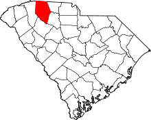 | |
| Towns | ||
| CDPs | ||
| Unincorporated communities | ||
| Ghost town | ||
| Footnotes | ‡This populated place also has portions in an adjacent county or counties | |
This article is issued from Wikipedia - version of the 7/4/2016. The text is available under the Creative Commons Attribution/Share Alike but additional terms may apply for the media files.