Flagg, Oregon
| Flagg, Oregon | |
|---|---|
| Unincorporated community | |
  Flagg, Oregon | |
| Coordinates: 44°01′30″N 123°29′58″W / 44.02500°N 123.49944°WCoordinates: 44°01′30″N 123°29′58″W / 44.02500°N 123.49944°W | |
| Country | United States |
| State | Oregon |
| County | Lane |
| Elevation | 551 ft (168 m) |
| Time zone | Pacific (PST) (UTC-8) |
| • Summer (DST) | PDT (UTC-7) |
| ZIP code | 97487 |
| GNIS feature ID | 1136291 |
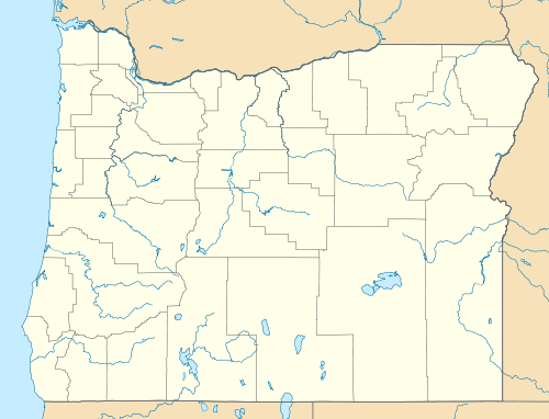
Flagg, Oregon, began as a railroad station on the Southern Pacific Line from Eugene to Coos Bay and later became an unincorporated community in Lane County, Oregon, United States, on Penn Road approximately 5 miles (8 km) west of Vaughn.[1] Wildcat Creek, a tributary of the Siuslaw River, flows by Flagg.[2]
Flagg was named for L. Randolph Flagg, a railroad contractor.[3]
References
- ↑ "Flagg (historical)". Geographic Names Information System. United States Geological Survey. November 28, 1980. Retrieved October 18, 2011.
- ↑ "United States Topographic Map". United States Geological Survey. Retrieved March 10, 2016 – via ACME Mapper.
- ↑ McArthur, Lewis A.; Lewis L. McArthur (1982) [1928]. Oregon Geographic Names (5th ed.). Portland, Oregon: Oregon Historical Society Press. p. 279. ISBN 0-87595-114-7.
This article is issued from Wikipedia - version of the 3/11/2016. The text is available under the Creative Commons Attribution/Share Alike but additional terms may apply for the media files.