Glencoe, Queensland
| Glencoe Queensland | |||||||||||||
|---|---|---|---|---|---|---|---|---|---|---|---|---|---|
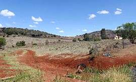 Rural home and fields, 2014 | |||||||||||||
  Glencoe | |||||||||||||
| Coordinates | 27°27′S 151°52′E / 27.450°S 151.867°ECoordinates: 27°27′S 151°52′E / 27.450°S 151.867°E | ||||||||||||
| Population | 385 (2011)[1] | ||||||||||||
| Postcode(s) | 4352 | ||||||||||||
| LGA(s) | Toowoomba Region | ||||||||||||
| State electorate(s) | |||||||||||||
| Federal Division(s) | Groom | ||||||||||||
| |||||||||||||
Glencoe is a locality in the Toowoomba Region local government area of the Darling Downs in southern Queensland, Australia.[2] At the 2011 Australian Cenus Glencoe and surrounds recorded a population of 385.[1]
The area was once known as Gowrie Scrub.[3]
Amenities
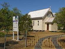
Bethlehem Lutheran Church, Glencoe, 2007
The Bethlehem Lutheran Church opened in 1880 and celebrated its 125th anniversary in 2005.[4]
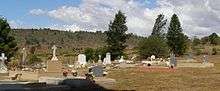
Lutheran cemetery, Glencoe, 2007
Two cemeteries are located adjacent to one another in Glencoe Road. One is associated with the neighbouring Lutheran Church; the other is a non-denominational cemetery operated by the Toowoomba Regional Council.[5]
References
- 1 2 Australian Bureau of Statistics (31 October 2012). "Glencoe (State Suburb)". 2011 Census QuickStats. Retrieved 11 November 2014.
- ↑ "Glencoe (entry 47949)". Queensland Place Names. Queensland Government. Retrieved 12 November 2014.
- ↑ "Glencoe". Queensland Places. Centre for the Government of Queensland, University of Queensland. Retrieved 11 November 2014.
- ↑ Bethlehem Lutheran Church (Glencoe, Qld.) (2005), Bethlehem Lutheran Church : Glencoe 125th anniversary : 1880-2005, Glencoe Lutheran Church, ISBN 978-1-921151-09-5
- ↑ "Glencoe". Toowoomba Regional Council. Retrieved 11 November 2014.
External links
 Media related to Glencoe, Queensland at Wikimedia Commons
This article is issued from Wikipedia - version of the 9/11/2016. The text is available under the Creative Commons Attribution/Share Alike but additional terms may apply for the media files.