Wellcamp, Queensland
| Wellcamp Toowoomba, Queensland | |||||||||||||
|---|---|---|---|---|---|---|---|---|---|---|---|---|---|
| Coordinates | 27°33′07″S 151°49′55″E / 27.552°S 151.832°ECoordinates: 27°33′07″S 151°49′55″E / 27.552°S 151.832°E | ||||||||||||
| Population | 302 (2011 census)[1] | ||||||||||||
| • Density | 14.88/km2 (38.53/sq mi) | ||||||||||||
| Postcode(s) | 4350 | ||||||||||||
| Area | 20.3 km2 (7.8 sq mi) | ||||||||||||
| Location | 12 km (7 mi) W of Toowoomba | ||||||||||||
| LGA(s) | Toowoomba Region | ||||||||||||
| State electorate(s) | Condamine | ||||||||||||
| Federal Division(s) | Groom | ||||||||||||
| |||||||||||||
Wellcamp is a locality in Toowoomba Region, Queensland, Australia, located 12 kilometres (7 mi) west of the city centre. At the 2011 Australian Census, Wellcamp and several other adjacent localities recorded a population of 302.[1]
History
The locality was named by the Railways Department after a camp for workers constructing the Toowoomba–Hendon railway, which happened to be located beside a well in the area. The line opened in 1869.
Wellcamp Provisional School opened on 27 February 1899, later becoming Wellcamp State School.[2][3]
Airport
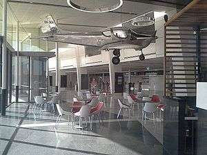
Terminal at Brisbane West airport
There is a jet-capable airport located within Wellcamp to service Toowoomba and the surrounding districts, it is known officially as Brisbane West Wellcamp Airport.[4]
References
- 1 2 Australian Bureau of Statistics (31 October 2012). "Wellcamp (State Suburb)". 2011 Census QuickStats. Retrieved 17 November 2014.
- ↑ "Opening and closing dates of Queensland Schools". Queensland Government. Retrieved 27 August 2015.
- ↑ "Agency ID5816, Wellcamp State School". Queensland State Archives. Retrieved 28 August 2015.
- ↑ "Wellcamp (entry 48089)". Queensland Place Names. Queensland Government. Retrieved 28 August 2015.
Further reading
- Wellcamp State School (1974), Wellcamp State School, 1899-1974 : 75th jubilee, s.n
- Pennycuick, Rae; Wellcamp State School. Centenary Committee (1999), Wellcamp State School : 1899-1999 : work and play in harmony, Centenary Committee, Parents and Citizens Association, Wellcamp State School, ISBN 978-0-646-37205-1
This article is issued from Wikipedia - version of the 10/4/2015. The text is available under the Creative Commons Attribution/Share Alike but additional terms may apply for the media files.