Gorenje, Kočevje
| Gorenje | |
|---|---|
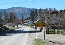 | |
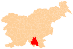
  Gorenje Location in Slovenia | |
| Coordinates: 45°40′14.41″N 14°51′16.43″E / 45.6706694°N 14.8545639°ECoordinates: 45°40′14.41″N 14°51′16.43″E / 45.6706694°N 14.8545639°E | |
| Country |
 Slovenia Slovenia |
| Traditional region | Lower Carniola |
| Statistical region | Southeast Slovenia |
| Municipality | Kočevje |
| Area | |
| • Total | 0.68 km2 (0.26 sq mi) |
| Elevation | 498 m (1,634 ft) |
| Population (2002) | |
| • Total | 327 |
| [1] | |
Gorenje (pronounced [ɡɔˈɾeːnjɛ]; in older sources also Gornja vas,[2][3] German: Obrern[3][4]) is a settlement north of Kočevje in southern Slovenia. The area is part of the traditional region of Lower Carniola and is now included in the Southeast Slovenia Statistical Region.[5] It includes the hamlets of Pri Studencu (German: Bein Brunnwirth)[3] and Plumbirt.[6]
Cultural heritage
A small late 19th-century chapel in the centre of the village is dedicated to Saint Joseph.[7]
Gallery
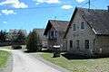 Old village core
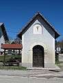 Village chapel
References
- ↑ Statistical Office of the Republic of Slovenia
- ↑ Intelligenzblatt zur Laibacher Zeitung, no. 141. 24 November 1849, p. 26.
- 1 2 3 Leksikon občin kraljestev in dežel zastopanih v državnem zboru, vol. 6: Kranjsko. 1906. Vienna: C. Kr. Dvorna in Državna Tiskarna, pp. 42–43.
- ↑ Ferenc, Mitja. 2007. Nekdanji nemški jezikovni otok na kočevskem. Kočevje: Pokrajinski muzej, p. 4.
- ↑ Kočevje municipal site
- ↑ Savnik, Roman, ed. 1971. Krajevni leksikon Slovenije, vol. 2. Ljubljana: Državna založba Slovenije, p. 222.
- ↑ Slovenian Ministry of Culture register of national heritage reference number ešd 14005
External links
 |
Wikimedia Commons has media related to Gorenje. |
This article is issued from Wikipedia - version of the 8/15/2014. The text is available under the Creative Commons Attribution/Share Alike but additional terms may apply for the media files.