Nantawarra, South Australia
| Nantawarra South Australia | |||||||||||||
|---|---|---|---|---|---|---|---|---|---|---|---|---|---|
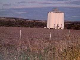 View of Nantawarra's silos from Highway 1, facing east | |||||||||||||
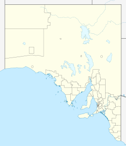  Nantawarra | |||||||||||||
| Coordinates | 34°01′23.1″S 138°13′35.6″E / 34.023083°S 138.226556°ECoordinates: 34°01′23.1″S 138°13′35.6″E / 34.023083°S 138.226556°E | ||||||||||||
| Postcode(s) | 5550 | ||||||||||||
| Location |
| ||||||||||||
| LGA(s) | Wakefield Regional Council | ||||||||||||
| State electorate(s) | |||||||||||||
| Federal Division(s) | |||||||||||||
| |||||||||||||
Nantawarra is a locality in South Australia located about 120 kilometres (75 mi) north of the Adelaide city centre and within the local government area known as the Wakefield Regional Council.[2][3][4] The locality occupies land on both sides of Highway 1 between Port Wakefield in the south and Snowtown in the north.[1] Nantawarra is recognisable from a distance by the presence of grain silos immediately just east of the Adelaide-Port Augusta railway line. The name Nantawarra may derive from the word nantuwara (meaning a northern yerta, or family group) in Kaurna, the language of the indigenous people of this part of South Australia.
See also
- List of cities and towns in South Australia
- List of South Australian Country Fire Service groups and brigades
- Railway accidents in South Australia
- Yorke Peninsula Field Days
References
- 1 2 3 4 5 6 7 8 "Wakefield Regional Council Map" (PDF). Wakefield Regional Council. Retrieved 16 May 2015.
- ↑ "Wakefield Regional Council". Local Government Association of South Australia. Retrieved 15 May 2015.
- ↑ "Suburbs and rural localities list" (PDF). Department of Planning, Transport and Infrastructure. Retrieved 16 May 2015.
- ↑ "Search result for "Nantawarra" (Record ID SA0048633)". Geoscience Australia. Retrieved 16 May 2015.
This article is issued from Wikipedia - version of the 10/9/2016. The text is available under the Creative Commons Attribution/Share Alike but additional terms may apply for the media files.