Roseway, Portland, Oregon
| Roseway | |
|---|---|
| Neighborhood | |
|
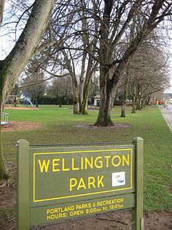
Wellington Park, Roseway. | |
  Roseway | |
|
Coordinates: 45°32′54″N 122°35′20″W / 45.54822°N 122.58889°WCoordinates: 45°32′54″N 122°35′20″W / 45.54822°N 122.58889°W PDF map | |
| Country | United States |
| State | Oregon |
| City | Portland |
| Government | |
| • Association | Roseway Neighborhood Association |
| • Coalition | Central Northeast Neighbors, Inc. |
| Area | |
| • Total | 0.81 sq mi (2.09 km2) |
| Population (2000)[1] | |
| • Total | 6,185 |
| • Density | 7,660/sq mi (2,959/km2) |
| Housing[1] | |
| • No. of households | 2647 |
| • Occupancy rate | 97% occupied |
| • % households renting | 24% renting |
| • Avg. household size | 2.34 persons |
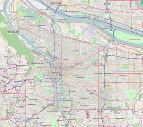
Roseway is a neighborhood in the Northeast section of Portland, Oregon. It is bordered by the neighborhoods Cully to the north (at NE Prescott St.) and west (at NE 62nd Ave.), Sumner to the northeast, Madison South to the east (at NE 82nd Ave.) and south (at NE Sacramento St.), and Rose City Park to the west (at NE 65th Ave.)
Roseway includes two parks: Wellington Park, acquired in 1941, and Glenhaven Park, acquired in 1948. Glenhaven is the larger of the two, and includes a skatepark, playground, fields for soccer, baseball and softball, tennis courts, disabled-access play area, restrooms, picnic tables, and a wading pool.
There are three public schools located within or adjacent to the Roseway neighborhood. These schools are Scott (K-8), Roseway Heights (K-8), and Madison High (8-12). The Gregory Heights branch of the Multnomah County Library is at NE 79th and Sandy.
Gallery
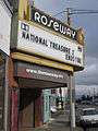 Historic Roseway Theater
 North on 72nd Ave.
References
External links
- Guide to Roseway Neighborhood - PortlandNeighborhood.com
- Roseway Neighbors