South Ripley, Queensland
| South Ripley Ipswich, Queensland | |||||||||||||
|---|---|---|---|---|---|---|---|---|---|---|---|---|---|
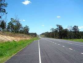 Centenary Highway, 2010 | |||||||||||||
  South Ripley | |||||||||||||
| Coordinates | 27°43′18″S 152°49′26″E / 27.7216°S 152.8238°ECoordinates: 27°43′18″S 152°49′26″E / 27.7216°S 152.8238°E | ||||||||||||
| Population | 344 (2011)[1] | ||||||||||||
| Postcode(s) | 4306 | ||||||||||||
| LGA(s) | City of Ipswich | ||||||||||||
| State electorate(s) | |||||||||||||
| Federal Division(s) | Blair | ||||||||||||
| |||||||||||||
South Ripley is a locality of the City of Ipswich in Queensland, Australia.[2] In the 2011 census, South Ripley had a population of 344 people.[1] The locality is planned to be part of the Ecco Ripley urban development area.
Geography
As a locality, South Ripley is the valley created by Bundamba Creek which runs in a north-south direction in the locality. Bundamba Lagoon is located in the south-east part of the locality.[3][4]
References
- 1 2 Australian Bureau of Statistics (31 October 2012). "South Ripley". 2011 Census QuickStats. Retrieved 20 November 2014.
- ↑ "South Ripley (entry 45078)". Queensland Place Names. Queensland Government. Retrieved 20 November 2014.
- ↑ "South Ripley, Queensland". Google Maps. Retrieved 20 November 2014.
- ↑ "Bundamba Lagoon (entry 5210)". Queensland Place Names. Queensland Government. Retrieved 20 November 2014.
External links
- "Ipswich Southern Localities". Queensland Places. Centre for the Government of Queensland, University of Queensland.
This article is issued from Wikipedia - version of the 5/10/2016. The text is available under the Creative Commons Attribution/Share Alike but additional terms may apply for the media files.