Lower Mount Walker, Queensland
| Lower Mount Walker Queensland | |||||||||||||
|---|---|---|---|---|---|---|---|---|---|---|---|---|---|
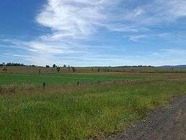 Fields along Stokes Crossing Road, 2015 | |||||||||||||
  Lower Mount Walker | |||||||||||||
| Coordinates | 27°46′17″S 152°29′47″E / 27.77139°S 152.49639°ECoordinates: 27°46′17″S 152°29′47″E / 27.77139°S 152.49639°E | ||||||||||||
| Population | 264 (2011)[1] | ||||||||||||
| Postcode(s) | 4340 | ||||||||||||
| LGA(s) |
Scenic Rim Region City of Ipswich | ||||||||||||
| State electorate(s) |
Beaudesert Lockyer | ||||||||||||
| Federal Division(s) |
Wright Blair | ||||||||||||
| |||||||||||||
Lower Mount Walker is a locality split between the Scenic Rim Region and City of Ipswich local government areas of South East Queensland, Australia. At the 2011 Australia Census the locality and surrounds recorded a population of 264.[1]
Geography
The Bremer River passes through the locality. Lower Mount Walker is home to a remnant swamp tea-tree forest which is considered critically endangered.[2]
History
The Mount Walker Lower State School opened on 12 November 1923 and closed about 31 August 1945.[3]
References
- 1 2 Australian Bureau of Statistics (31 October 2012). "Lower Mount Walker(State Suburb)". 2011 Census QuickStats. Retrieved 27 March 2015.
- ↑ Neroli Roocke (8 December 2011). "Call to arms for endangered Queensland forest". ABC Rural. Australian Broadcasting Corporation. Retrieved 27 March 2015.
- ↑ "Agency ID9147, Mount Walker Lower State School". Queensland State Archives. Retrieved 13 April 2015.
This article is issued from Wikipedia - version of the 4/13/2015. The text is available under the Creative Commons Attribution/Share Alike but additional terms may apply for the media files.