Arthurton
| Arthurton South Australia | |||||||||||||
|---|---|---|---|---|---|---|---|---|---|---|---|---|---|
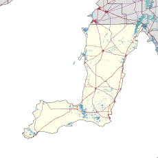  Arthurton | |||||||||||||
| Coordinates | 34°15′30″S 137°45′20″E / 34.2582°S 137.7555°ECoordinates: 34°15′30″S 137°45′20″E / 34.2582°S 137.7555°E | ||||||||||||
| Population | 295 (2006 census)[1] | ||||||||||||
| Established | 1876 | ||||||||||||
| Time zone | ACST (UTC+9:30) | ||||||||||||
| • Summer (DST) | ACDT (UTC+10:30) | ||||||||||||
| LGA(s) | Yorke Peninsula Council | ||||||||||||
| State electorate(s) | Goyder[2] | ||||||||||||
| Federal Division(s) | Grey[3] | ||||||||||||
| |||||||||||||
| Footnotes | Adjoining localities[4] | ||||||||||||
Arthurton is a settlement in the Australian state of South Australia.[5] At the 2006 census, Arthurton had a population of 295.[1]
Arthurton was surveyed in 1876. It was named after Arthur, the son of South Australian Governor Anthony Musgrave,[6] who insisted on this name after it had already been named "Kalkabury".[7]
See also
References
- 1 2 Australian Bureau of Statistics (25 October 2007). "Arthurton (State Suburb)". 2006 Census QuickStats. Retrieved 25 July 2011.
- ↑ "Federal electoral division of Grey" (PDF). Australian Electoral Commission. Retrieved 24 July 2015.
- ↑ "Goyder electorate boundaries as of 2014". ELECTORAL COMMISSION SA. Retrieved 23 July 2015.
- ↑ "New Ward Structure 2014". Yorke Peninsula Council. Retrieved 21 October 2015.
- ↑ "2905.0 - Statistical Geography: Volume 2 -- Census Geographic Areas, Australia, 2006". Australian Bureau of Statistics. Retrieved 8 December 2009.
- ↑ "Property Location Browser Report, Placename Details: Arthurton". Property Location Browser gazetteer. Department of Planning, Transport and Infrastructure, Government of South Australia. 17 October 2013. SA0003323. Retrieved 8 January 2015.
- ↑ "Manning index of place names". State Library of South Australia. Retrieved 22 June 2015.
This article is issued from Wikipedia - version of the 6/25/2016. The text is available under the Creative Commons Attribution/Share Alike but additional terms may apply for the media files.