Winulta, South Australia
| Winulta South Australia | |||||||||||||
|---|---|---|---|---|---|---|---|---|---|---|---|---|---|
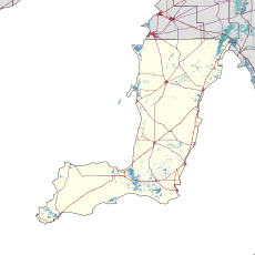  Winulta | |||||||||||||
| Coordinates | 34°17′S 137°52′E / 34.28°S 137.86°ECoordinates: 34°17′S 137°52′E / 34.28°S 137.86°E | ||||||||||||
| Postcode(s) | 5570 | ||||||||||||
| LGA(s) | Yorke Peninsula Council | ||||||||||||
| State electorate(s) | Goyder[1] | ||||||||||||
| Federal Division(s) | Grey[2] | ||||||||||||
| |||||||||||||
| Footnotes | Adjoining localities[3] | ||||||||||||
Winulta was a town in the Australian state of South Australia on northern Yorke Peninsula around 10 km from Clinton on the Clinton-Maitland road, and was first settled for farming around 1876. The earliest farmers were William Short, Thomas Kenny and John Sharrad.[4]
The nearby "Hundred of Tiparra School" opened in 1884, was renamed "Winulta School" in 1891 and closed in 1950.[5]
See also
References
- ↑ "Goyder electorate boundaries as of 2014". Electoral Commission SA. Retrieved 23 July 2015.
- ↑ "Federal electoral division of Grey" (PDF). Australian Electoral Commission. Retrieved 24 July 2015.
- ↑ "New Ward Structure 2014". Yorke Peninsula Council. Retrieved 21 October 2015.
- ↑ "Y.P. Octogenarian Honored". The Kadina and Wallaroo Times (SA : 1888 - 1954). SA: National Library of Australia. 30 October 1926. p. 2. Retrieved 25 October 2015.
- ↑ "Manning Dictionary of South Australian Placenames". State Library of South Australia. Retrieved 25 October 2015.
External links
| Major Townships | |||||||||||
|---|---|---|---|---|---|---|---|---|---|---|---|
| Minor Townships | |||||||||||
| Governance |
| ||||||||||
| Coastal features | |||||||||||
| Protected areas |
| ||||||||||
| Islands adjoining the Yorke Peninsula coast | |||||||||||
| Related and uncategorised | |||||||||||
| |||||||||||


This article is issued from Wikipedia - version of the 6/25/2016. The text is available under the Creative Commons Attribution/Share Alike but additional terms may apply for the media files.